Archived Storm Damage Blog Posts
Flood Damage Cleanup in Waldorf Happens Fast with SERVPRO
2/1/2025 (Permalink)
 Submersible pumps expedite SERVPRO's team to remove floodwaters in Waldorf properties prior to drying and disinfecting. Here to Help®
Waldorf Homeowners Rely on SERVPRO® for Flood Damage Restoration
Flood damage can disrupt your life and leave your home vulnerable to further issues if you don’t address it promptly. SERVPRO can help you with quick and efficient flood damage restoration of your Waldorf home.
SERVPRO’s IICRC-certified technicians work quickly to contain flood damage to your Waldorf property. We use tools like extractors and dehumidifiers to remove standing water, dry affected areas, and protect your property. SERVPRO techs also restore storm damage to your home with care and precision, quickly returning it to preloss condition.
SERVPRO’s Water Removal Services
Contaminated floodwaters after a storm can cause extensive damage to your Waldorf property. SERVPRO technicians use advanced water extraction equipment to address the issue effectively and protect your property. We focus on rapid water removal to minimize structural damage and prevent secondary problems like contamination and mold growth.
SERVPRO’s water extraction process involves a combination of powerful tools, each designed to handle specific aspects of flood cleanup. These tools allow our techs to remove standing water, extract moisture from porous materials, and ensure no hidden water remains on your property.
Here are some extraction equipment that we use during water cleanup:
- Submersible pumps: Techs use these to quickly remove large volumes of standing water from basements or other heavily flooded areas of your home.
- Truck-mounted extractors: We use high-capacity systems to extract water from large spaces, making them ideal for extensive flood damage control.
- Portable extractors: Our techs use these small units to reach tight or confined spaces, ensuring they can remove water from every corner of your home.
After we extract the water, we thoroughly assess any remaining moisture and use dehumidifiers and air movers to dry your home.
Role of Air Filtration Devices (AFDs) in Water Damage Restoration
AFDs are a crucial component of our water damage restoration process. SERVPRO technicians use AFDs to remove airborne contaminants like dust and debris from your flooded home, ensuring a safer indoor environment. These devices also improve air quality while drying, protecting your property and health.
Call SERVPRO of Charles County and Oxon Hill at (301) 753-8313 today.
Waldorf Flood Damage Restoration and Repair in Waldorf
4/3/2024 (Permalink)
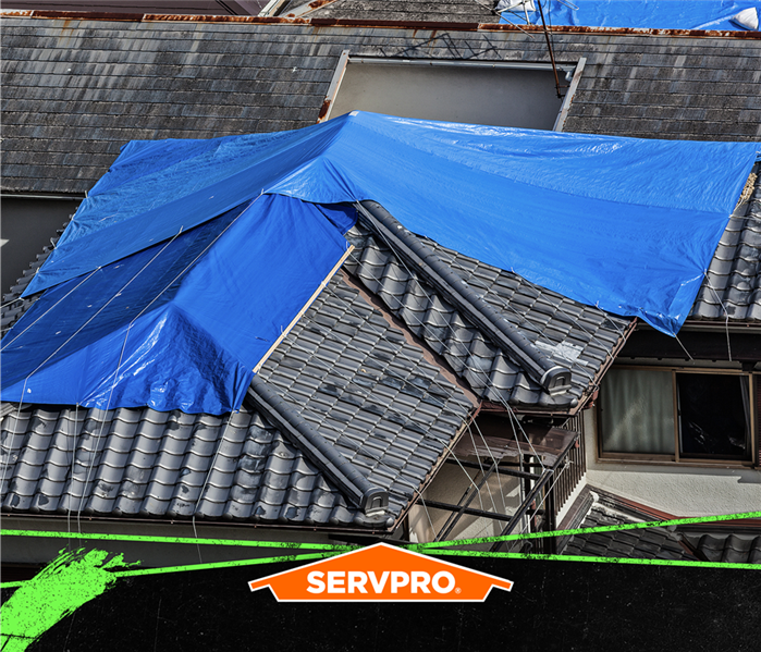
 We are Faster to any size disaster. SERVPRO swiftly tarps storm-damaged Waldorf roofs to mitigate damage. Then we can restore the property.
SERVPRO Provides Flood Damage Cleanup After Storms Hit the Waldorf Area
Many residents of Waldorf who have experienced damage from flooding and storms are taking action to prevent or reduce the damage from future storms. They have seen their homes flooded and damaged by storms, made repairs, and restored them after being flooded. Installing reflux valves and sump pumps, elevating electrical panels, checking insurance coverage, and preparing a flood emergency plan are a few of the steps homeowners can consider to protect their homes and save them thousands of dollars.
SERVPRO® can be on-site at your Waldorf home to help with flood damage within four hours of your call. Our fast response mitigates the damage caused by lingering water and moisture and limits mold infestations. We deploy high-capacity pumps, dehumidifiers, and air movers to remove debris, water, and moisture from your home. Our technicians cover broken windows and doors and place tarpaulins on roof punctures to further limit additional damage.
Homeowners experience many emotions during a storm and after they are faced with the damage caused by flooding. There are several essential steps to consider:
- Move your family to a safe environment
- Call SERVPRO for help
- Flooded electrical appliances, light fixtures, and entertainment devices should be avoided
- Ensure the electricity is shut off before entering flooded areas
- Whenever it is safe, move contents and valuable documents to dry areas
Our SERVPRO team cleans and disinfects all surfaces, including fabrics and contents. We replace damaged drywall and flooring materials and paint walls as needed. Our project managers work closely with all tradespeople to ensure that the repair and restoration activity is completed in a timely manner. They also work with your insurance company to manage the paperwork and the claims process to help manage the stress of dealing with the damage to your home.
Call for help with flood damage cleanup, restoration and repairs at SERVPRO of Charles County and Oxon Hill and nearby areas. Call (301) 753-8313.
Guidelines for Safeguarding Your Business During Hurricane Season | SERVPRO of Charles County/Oxon Hill
8/23/2023 (Permalink)
 Is your Maryland business in need of storm damage repair? Call SERVPRO of Charles County/Oxon Hill to get your space back.
Running a business can be quite a challenge. You've got many tasks to handle while keeping an eye on your daily activities and long-term goals. It's like a skillful juggling act. Amidst your busy schedule, it's essential not to forget about getting ready for severe weather. Unexpected weather events can cause chaos in your business and put your employees' safety at risk.
Your team relies on you to have a solid plan in place. Here are some simple steps to create a strong plan that ensures everyone's safety when severe weather strikes:
Understanding the Risks
Weather risks vary depending on where you are, and they can change with the seasons. In Charles County, we mainly face heavy rainfall, strong winds, and potential flooding. Just one flood can cause significant damage in a short time.
It's also crucial to understand how vulnerable your business location is. This knowledge helps you prepare for disasters and consider getting flood insurance if necessary. Staying updated on weather patterns and weekly forecasts further boosts your preparedness.
Effective Communication
In our connected world, communication is easier than ever. Make sure you have everyone's contact information on hand so you can quickly share updates about severe weather.
If bad weather is on the horizon, you can swiftly share the location of safe shelters and provide instructions on accessing emergency supplies or how to evacuate if needed.
Swift and Safe Evacuation
Your staff's safety is the top priority during any weather crisis. Knowing how to evacuate quickly is crucial. Familiarize everyone with the evacuation routes and exit points in your building, all clearly marked. Consider posting evacuation plans near exits for added convenience during actual emergencies.
However, evacuating might not always be possible, depending on the situation outside. To prepare for this, create a secure shelter with food, water, and an emergency kit, ensuring your team's comfort in case they need to take cover.
Practice various scenarios multiple times, so everyone understands their role during emergencies. This proactive approach ensures safety, no matter the weather.
Don't let extreme weather take control! If storms affect your business, SERVPRO® is ready to help you recover any losses.
Summer Storms
8/18/2022 (Permalink)
Southern Maryland knows all too well what these storms can bring us, especially if you live near the water. The summer of 2022 is the hottest one yet with lots of humidity, and we are enjoying the freedom to be out and about. However, the hot summer also brings these unpredictable, quick moving summer storms resulting in high winds, heavy rainfall, lots of flooding and oftentimes, property damage.
With all these storms rolling in means humidity and thunderstorms in southern Maryland is famous for our summer storms rolling in and giving us inches of rain a then rolling out like nothing ever happened.
Being prepared for summer storms is essential. The following are steps that we recommend at a minimum:
- Weekly checks of your sump pump
- Clean gutters and drains
- Check around your foundation and downspouts
- Cut or trim trees in danger of falling
- Important paper should be kept in a waterproof container
- Assemble a disaster supply kit
- Review insurance policies
You should make a habit of doing these checks on a regular basis no matter the season. These simple things could save you thousands of dollars and not to mention headaches!
But, if you ever find yourself with water in your home, excess humidity, or other damage from a storm, call your local SERVPRO professionals to come out and look at your home. We can help guide you through the steps toward restoration and remediation. We are here to help and available 24 x 7. Call SERVPRO of Charles County and SERVPRO of Oxon Hill 24/7/365 Emergency Services at 301-753-8313.
Hailstorm
8/18/2022 (Permalink)
 Hailstorm Damage
Occasionally, we southern Marylanders encounter a hailstorm. Let’s discuss what causes hail and its impact.
What is and what causes hail?
Often round in shape, hail is layered ice particles produced by thunderstorms with strong, tilted updrafts. They usually form within a unusually unstable air mass in which the temperature falloff with height is much greater than normal. The unstable air is required to create large updraft speeds -- fast enough to keep a developing hailstone from hitting the ground.
- Hailstorms are the identifier of a strong thunderstorm.
- The eventual size of the hail depends on how long they can defeat gravity.
- Hail size depends on the strength of the updraft.
- The bigger the hail balls are, the harder they fall.
- The largest hailstone ever recorded was the size of a volleyball.
- Hail causes $1 billion in damage each year with millions of ice balls ranging in size from golf balls to grapefruits.
- Oklahoma is the large hail champion in the United States.
Regardless of the type of storm, we recommend:
- Check your surroundings and make sure you are safe.
- Contact your insurance company.
- Inspect the roof and exterior siding.
- Check other outside structures
- Inspect your home’s appliances
- Check the attic, crawlspaces and basement.
- Document any and all damage.
In the event of an emergency, we are here to help and available 24 x 7. Call SERVPRO of Charles County and SERVPRO of Oxon Hill 24/7/365 Emergency Services at 301-753-8313.
Winter Warm and Cozy
12/20/2021 (Permalink)
 Snow Covered Homes
Although you may be all warm and fuzzy with thoughts of freshly fallen snow, a crackling fire and a warm mug of hot chocolate, damage that may come from a winter storm is infinitely less cozy. Storm and flood damage can be devastating and occur when you least expect it. Storm damage may include flooding from heavy rainfall, snow, freezing pipes or roof leaks from heavy wind and driven rains. Here are some steps to make your home more resistant during a storm:
- Protect potential wind and water entry points
- Make sure roof shingles are secure using roofing cement
- Make sure any openings or cracks by phone and cable lines are chalked up
- Install proper weighted shutters to cover your windows and doorways
- Invest in a heavy-duty garage
- Protect and secure your HVAC system
- Secure any loose item outside i.e., bikes and trashcans
But in the event your winter dreams of sugar plums fairies and candy canes turn into a personal version of the Grinch who stole Christmas, SERVPRO® of Charles County and SERVPRO® of Oxon Hill are here to help! We can be reached by calling on (301) 753-8313 for storm damage repair and restoration service.
When the Storms Come...
10/19/2021 (Permalink)
 Stormy Weather
Storm and flood damage can be devastating and occur when you least expect it. Storm damage encounters may include flooding from heavy rainfall or roof leaks from heavy wind-driven rain. Here are some useful measures you can do to make your home more resistant during a storm:
- Protect potential wind and water entry points
- Make sure roof shingles are secure using roofing cement
- Make sure any openings or cracks by phone and cable lines are chalked up
- Install proper weighted shutters to cover your windows and doorways
- Protect and secure your HVAC system
- Secure any loose item outside, i.e. bikes and trashcans
After the Storm, SERVPRO® of Charles County and SERVPRO® of Oxon Hill are here to support you! Call SERVPRO® of Charles County, 301.753.8313 or SERVPRO® of Oxon Hill, 301.292.4447. We provide free visual inspections, and we will guide you through the claim, cleanup and reconstruction processes as necessary. We are Here to Help!
Storms and Fear
8/4/2021 (Permalink)
 Some animals fear storms
Storms come in all shapes and sizes. The one that comes to mind the most often are thunderstorms. However, tropical, lightning, flood, snow, ice and hurricane are just another few types of storms that exist. Some are scarier than others, and some are more of a nuisance than anything.
Did you know that tropical storms are given names before hurricane season begins? They have to get pre-approved by the World Meteorological Organization and can be repeated after six years. If there is a storm that causes major destruction, that name is retired permanently and replaced with a different one.
Astraphobia is the extreme fear of thunder and lightning. While children and adults suffer from this fear, animals do as well. This causes them to run and hide or howl. Did you know that often times, pets can sense a storm coming before we can? That could be why it always seems quiet outside before a storm hits, pets are busy looking for shelter and a place to hide. Your pet may hide under blankets, pace a lot, tremble or pant when a storm is either coming or already happening. Be fearless knowing that no matter the type of storm, SERVPRO® of Charles County and SERVPRO® of Oxon Hill are here to help!
Storm Variety
7/4/2021 (Permalink)
Understanding Common Types of Storm Scenarios
Storms can be sometimes, really frightening and dangerous. Once the disaster is passed, call the professionals from SERVPRO® of Charles County and SERVPRO® of Oxon Hill to assess your property and start the repair and restoration process. Here are some common storm scenarios that you should be aware of:
Hail Damage: Dents and bents are common during a hailstorm, but deeper damage may not be visible. In this case, take an expert opinion as hailstorm damage can lead to serious roof leaks causing structural issues.
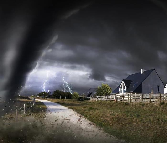
Lightning and Thunderstorm Damage: Electrical Damage can be a life-threatening during lightning and thunderstorms. Stay indoors till the storm is over and once it has passed, give us a call at SERVPRO® of Charles County and SERVPRO® of Oxon Hill.
Storm-related flood Damage: Flooding can have a serious impact on your property. River floods, flash floods, coastal floods and storm surges can destroy your home. It is recommended to keep a track of weather reports and stay alert in certain situations.
Please call us at SERVPRO® of Charles County and SERVPRO® of Oxon Hill by calling (301) 753-8313 for storm damage repair and restoration service. We are Here to Help!
Storm Tips
5/29/2021 (Permalink)
 We are Here to Help!
Did you know that in the United States alone, an estimated 100,000 thunderstorms occur each year? Not only do thunderstorms produce rain, thunder, and lightning, they can also produce high winds, heavy rain, and flooding. The safest place to be during a thunderstorm is inside.
That is why it is so important to properly prepare your home for all the unexpected things that can happen when a storm comes your way. We at SERVPRO are here to help you prepare you and your home and help you after a storm has come through. Here are some helpful tips to prepare your home before a storm comes:
- Trim the trees in your surrounding area
- Buy a backup generator
- Install storm shutters
- Check your insurance to ensure flood coverage is available
- Flood-proof your home
- Have an expert check your home for any weak areas
- Protect your belongings – elevate all critical items in your home to ensure they do not get damaged due to flooding.
If your home sustains damage as a result of a storm, contact SERVPRO at 301-753-8313 because we are here to help!
Thunderstorms 101
4/5/2021 (Permalink)
 Raging Storms
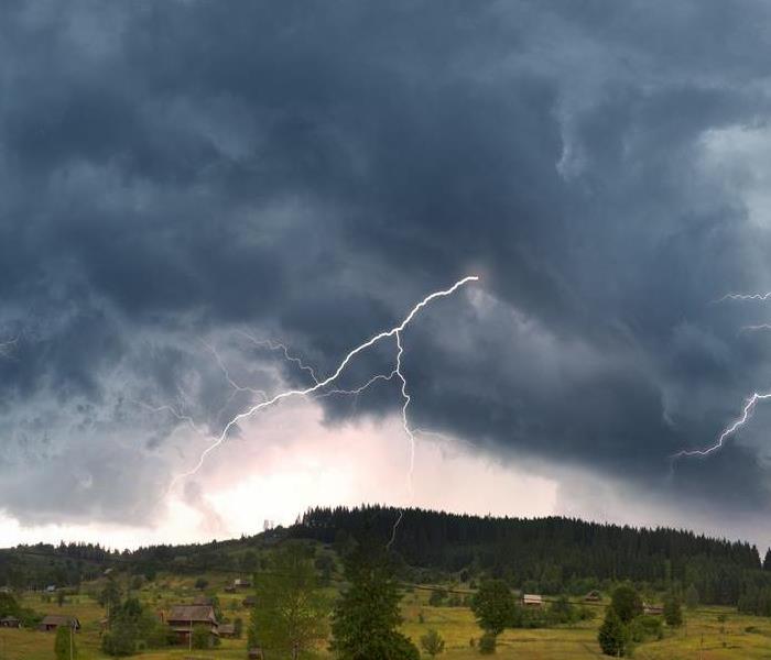
A rain shower in which you hear thunder is a thunderstorm. All thunderstorms have lightning since thunder comes from lightning. A “severe” thunderstorm is one which contains one or more of the following: hail one inch or greater, winds gusting in excess of 57.5 mph, or a tornado. Spring and summer months are when thunderstorms are most likely to occur during the afternoon and evening hours.
Many hazardous weather events are associated with thunderstorms. Under certain conditions, thunderstorm rainfall may cause flash flooding, killing more people each year than hurricanes, tornadoes or lightning. Fires started from lightning cause fatalities. These storms may produce hail up to the size of softballs which can do a lot of damage. Strong winds associated with thunderstorms can knock down trees, power lines and mobile homes.
A Severe Thunderstorm WATCH is issued by the NOAA Storm Prediction Center meteorologists who are watching the weather 24/7 across the entire U.S. for weather conditions that are favorable for severe thunderstorms. In the case of a Watch, be prepared for more severe weather.
A Severe Thunderstorm WARNING is issued by your local NOAA National Weather Service Forecast Office meteorologists who watch a designated area 24/7 for severe weather that has been reported by spotters or indicated by radar. Warnings mean there is a serious threat to life and property to those in the path of the storm. In the case of a warning, act immediately to find safe shelter!
If your home or business is damaged by a storm, our professionals at SERVPRO® of Charles County and SERVPRO® of Oxon Hill are here to help 24 x 7 at (301) 753-8313.
Stay Safe from Hurricanes!
11/19/2020 (Permalink)
This has been an unusual Hurricane season for Maryland and it is not over yet. While Hurricanes may not be as common as other disasters, it is still essential for you to learn how to act against this disaster.
A Hurricane holds the potential to expand its reach to hundreds of kilometers in a few minutes! During a Hurricane, consider doing the following:
- Keep your emergency kit close with you.
- Keep listening to the radio for further updates.
- Unplug appliances and turn off the electricity.
- Watch for water entering the home.
- Follow guidance of any emergency personnel.
Do not go outside of the house in case of a Hurricane. Stay inside the house with your family. If possible, shift your whole family to the most substantial part of the house.
After the Storm, SERVPRO® of Charles County and SERVPRO® of Oxon Hill are here to support you! Call SERVPRO® of Charles County, 301.753.8313 or SERVPRO® of Oxon Hill, 301.292.4447. We provide free visual inspections, and we will guide you through the claim, cleanup and reconstruction processes as necessary.
Stay Safe!
Generator Safety from SERVPRO®
10/8/2020 (Permalink)
Generator Safety from SERVPRO®
Here in Southern Maryland we know all too well that having a generator is important. When we decide to purchase generators, we are thinking about the good it will bring and what protection it offers. A generator can allow us to keep the lights on, fan or heaters going and as a mom I think of the refrigerator, we must preserve our food!
What we often forget are the safety concerns that come along with using a generator. Here are some generator safety tips to consider.
- Never use a generator inside the home or even in partially enclosed spaces, like the garage! Opening windows, doors and using fans will not prevent carbon dioxide buildup.
- Install carbon dioxide alarms in central locations on every level of your home.
- Do not use a generator in wet conditions. Make sure the generator is outside but not in the rain or snow as this could cause electrocution.
With Southern Maryland’s crazy weather patterns, we need to be prepared with knowledge and equipment to protect our families in a storm.
SERVPRO® of Charles County and SERVPRO® of Oxon Hill are available 24 hours a day – 7 days a week and YES even during the storm, so call us today: 301.753.8313 or 301.292.4447.
Tropical Storm Isaias expected to affect Southern Maryland this week!
8/3/2020 (Permalink)
Maryland is not normally known for hurricane related disasters, but it seems that within the last few years it has become increasingly common. With Topical Storm Isaias approaching the coastline SERVPRO® of Charles County and SERVPRO® of Oxon Hill find it important to prepare.
Hurricane Isaias has caused The National Weather Service to issue a Tropical Storm Watch and Flash Flood Watch for Monday afternoon through Tuesday evening for much of Maryland. In Southern Maryland tropical storm conditions are possible within 48 hours.
Tropical Storm Isaias is expected to cause winds from 40-70 MPH with about 3-4 inches of rain. The Eastern Shore could possibly see 7 plus inches of rain by Tuesday evening. Flash Flood warnings are issued for Southern Maryland from Monday afternoon through Tuesday evening.
During this time, it is important to take necessary measures to protect your family and your home.
- MEMA is reminding Maryland residents to make sure emergency kits include at least 2 face masks for each person as well as Hand Sanitizer, disinfectants, and other COVID-19 related supplies.
- Tie down any loose furniture or grills that are outside and subject to substantial winds and could be blown about causing secondary damage.
- Keep devices charges in case of power outages.
- If the roadway is flooded, TURN AROUND, do not attempt to drive through the standing water.
- Only use generators outdoors! Generators should be at least 20 feet away from home, doors, windows, and vents.
SERVPRO® of Charles County and SERVPRO® of Oxon Hill will be on standby if we are needed. In the time of an emergency we are still Here to Help! Do not hesitate to call us right away, 301.753.8313 or 301.292.4447.
Summer Heat Storm!
6/29/2020 (Permalink)
Summer is approaching fast! In Southern Maryland it seems we have gone from Winter to Summer again this year. Over the last few years, we have skipped spring and this year was no different. With that in mind it is important to remember extreme heat precautions, especially with COVID-19 causing us to do more outdoor activities because a lot of businesses are still closed.
Heat affects everyone but especially young, sick, elderly, and overweight people. There are several things you can do to prepare for extreme heat.
- Stay inside if possible
- Check on your pets if they are outside
- Stay hydrated! Limit alcohol or caffeine if outdoors.
- Wear loose, light colored clothing if outside.
- Apply sunscreen!
If you must be outside during extreme heat please be aware of the symptoms of heat exhaustion, such as heavy sweating, weakness, cold, clammy skin, nausea or vomiting and fainting. Heat exhaustion can lead to a heat stroke which is life threatening. Signs of heat strokes are body temperatures of 103 degrees +, rapid pulse and possible unconsciousness. If you think someone is having a heat stroke CALL 911, DO NOT give them fluids, try to reduce body temp with cool wet rags.
We want you to enjoy the outdoors this summer, especially because we have spent so much time indoors this year due to COVID, but we want you to be safe! Our community is our family and your safety is important to us!
Maryland’s 2020 hurricane season is predicted to be a rough one
5/29/2020 (Permalink)
As if the coronavirus was not enough, we are coming up on hurricane season 2020, June 1- November 30, and it is potentially going to be a tough one for the East coast. The 2020 hurricane season could produce 16 named storms for the Atlantic Coast, which is four more named storms than the average.
Colorado State University meteorologists are predicting that the 2020 hurricane season will be 140% of the average hurricane season. The team is predicting eight of the 16 storms will become hurricanes and four of the storms could become Category 3-5 storms and produce winds of 111 miles per hour.
The April forecast for hurricane season 2020 may seem a bit early but basing their predictions on over 50 years of data, has proven them well. The team from Colorado State will provide updates to their predictions as the season moves along and let us hope that there is a change for the better. I think I can speak for everyone in Southern Maryland, and across the Atlantic seaboard for that matter, when I say we would like a nice, calm, and uneventful remainder of 2020. The updates will be published on June 4, July 7 and August 6… keeping our fingers crossed.
As you know, no matter the time or situation SERVPRO® of Charles County and SERVPRO® of Oxon Hill are ALWAYS available and Here to Help! You can call us, 301.753.8313- Email us, Marketing@SERVPRO5407.com or find us on social media if you need our assistance.
SEVERE Weather
4/6/2020 (Permalink)
Severe weather can happen at anytime in America, but we definitely know it can happen at anytime in Southern Maryland. Each year as a country we deal with natural disasters more than you would imagine.
STORM Averages for the USA
10,000 severe thunderstorms
5,000 floods or flash floods
1.300 tornadoes
2 landfalling deadly tornadoes
That is a lot of storms every year causing nearly $15 billion in damage and 650 deaths. This was an eye-opening fact for me when I read it, noaa.gov. The only thing we can do is to be prepared. You should always educate yourself on the weather risk you could face in the places that you live and work. Sign up for wireless emergency alerts and listen to the radio. Create a communication plan for work and home. Put together and Emergency Kit and make sure everyone knows what it includes and where it is. Be prepared so you can be safe!
Even during Storm conditions SERVPRO® of Charles County and SERVPRO® of Oxon Hill is Here to Help! You can always reach someone from our office @ 301.753.8313.
Winter Storm- Southern Maryland Solar Minimum
11/13/2019 (Permalink)
Winter Storm- Southern Maryland Solar Minimum
Here in Southern Maryland we are currently in a Solar Minimum. What is a Solar Minimum? Well a Solar Minimum is when a Solar Activity is really low. Obviously right? What does this mean? When Solar activity is really low it has a direct impact on our atmosphere and weather. During a Solar Minimum the earth tends to cool. When the earth cools even slightly it could cause extreme drops in temperature which in turn could produce SNOW! With the Solar Minimum occurring please be aware of precipitation and below freezing temperatures. With all of the leaves falling in Southern Maryland be sure to check your drainage pipes for blockages and check your pipes for signs of freezing.
If you are in need of service we are available 24 hours a day and 7 days a week at 301.753.8313.
What is Winter 2019-2020 going to look like?
10/10/2019 (Permalink)
What is Winter 2019-2020 going to look like?
Anyone who knows me knowssss that I despise Winter. I think Winter is so awful that I don’t like my birthday because it’s during the frigid cold of Winter. Every Fall I find myself looking for predictions on what is just around the corner, yes you guessed it, WINTER!
Over the years I have grown to find the Farmers Almanac reliable so naturally, that’s where I started.
WOW! To my surprise I was pleased, for the most part, with what the Farmers Almanac had to say for our Southern Maryland Region.
Winter temperatures will be much above normal, on average, with the coldest periods in mid- and late January and early and late February. Precipitation will be above normal, with below-normal snowfall.
But of course, it couldn’t all be sunshine in rainbows…
The snowiest periods will occur in mid- and late January and early February.
GREAT! Just what I wanted for my birthday! SNOW! (Complete sarcasm here)
Most people look forward to Snow because of school closings, hot chocolate, sledding, snowman and the beautiful scenery, yes sometimes it is beautiful, but not I. When I hear of snow coming to town, I think about packed grocery stores, wet clothes, dangerous roads and most of all, water damages.
Water damages are frequently paired with snowstorms due to sump pump failure, power outages and burst pipes. I know the damage it can cause a family and that is why I am proud to be a part of the SERVPRO® of Charles County and SERVPRO® of Oxon Hill family.
SERVPRO® of Charles County and SERVPRO® of Oxon Hill are always “Here to Help” and genuinely care about taking care of your family and home!
When is need please do not hesitate to call us 24/7 @ 301.753.8313.
Shocking facts about lightning
9/17/2019 (Permalink)
Shocking facts about lightning
Lightning is one of the leading causes of weather related deaths even though the odds of being struck in a years’ time is 1 in 500,000. There are multiple factors that put you at a greater risk for being struck. Here are a few safety tips to help you out:
- Check the forecast before participating in outdoor activities- If you decide to go still please make sure there are shelter options nearby.
- When thunder roars go indoors. – This catch phrase is something to remember at all times. Safe shelters include homes, offices, stores and hard top vehicles with windows rolled up.
- Avoid windows, doors, porches and concrete as lightening can travel through these things.
- Avoid water- Do not bathe, shower, do dishes or anything with water as lightning can travel through plumbing.
Severe Thunderstorm Warnings
8/30/2019 (Permalink)
Severe Thunderstorm Warnings
During the summer months we often hear of Severe Thunderstorm Warnings in our area. They rend to become common occurrences, just like this summer. When they are issued frequently we tend to pass over them as if they are not extremely dangerous and even deadly.
Severe Thunderstorm Warnings come with the possibility of destructive winds, hail, the possibility of tornadoes and frequent lightning.
The destructive winds during a Severe Thunderstorm Warning may be strong enough to knock down trees and powerlines which pose a great threat to your property. Hail during this time can put dents in your car and ruin the shingles on your roof at the smallest size. As the hail gets bigger you run the risk of broken windows and actual holes in your roof. During this warning in a span of minutes with low-level rotation could form a tornado. As we all know if you can hear thunder you are close enough to get struck by lightning so during a Severe Thunderstorm Warning you should take the proper precautions.
If you experience a loss in your home, please do not hesitate to call SERVPRO® of Charles County and SERVPRO® of Oxon Hill immediately. 301.753.8313.
Lightening Safety
8/2/2019 (Permalink)
Storm: Lightening Safety
Lightening Strikes the United States over 25 million times a year. That is a crazy big number! Mostly we see lightening in the summer months due to the heat but you can see lightening at any time. Did you know that thunder is created by lightening so even if you don’t see lightening but you hear thunder it is there! If you hear thunder or see lightening you should go inside. Most lightening strikes involving people are due to people enjoying themselves outside and not seeking shelter.
Have you ever heard of the 30/30 rule when it comes to lightening? “If it takes less than 30 seconds to hear thunder after seeing the lightening flash, lightening is close enough to pose a threat! After a storm wait 30 minutes before going back outside”
The best way to protect you and your loved ones from lightening is to avoid the threat. Stay indoors!
The three types of floods… and yes they can all occur in Southern Maryland!
7/14/2019 (Permalink)
The three types of floods… and yes they can all occur in Southern Maryland!
A flood is an overflow of large amounts of water in what is normally pretty dry areas. There are three main types of floods that can occur depending on your geographical area. The scary thing about floods is that each kind is different and requires different actions to prepare and to recover. The three main types of floods are Fluvial (river), Pluvial (surface) and Coastal Floods.
Fluvial floods (river floods)
A Fluvial flood happens when the water level in a river overflows the surrounding areas due to excessive rain or snow melting. The damage from river floods can be widespread depending on the river, lake or stream size and the area around it.
Pluvial floods (flash floods and surface water)
Flash Floods and overwhelmed drainage systems make up the Pluvial flood family. Pluvial floods occur when extreme sudden rainfall hits an area and causes a flood that is not caused by an overflowing body of water. An Overwhelmed drainage system water flows out into the surrounding areas and could potentially flood surrounding areas. Flash floods occur with torrential rain in a short amount of time. Flash floods are extremely dangerous not just because of the abundance of water but because of the potential debris associated with the area.
Coastal flood (storm surge)
Coastal flooding is conducive of areas along the coast. Coastal floods are normally caused by windstorms occurring at the same time as high tide- called storm surge. This is when the high wind forces the water to land and causes coastal floods.
Floods are very unpredictable and can happen in a moment, so it is very important that you listen to your local weather and emergency services personnel. Be prepared and be careful. If you experience flooding in Southern Maryland please do not hesitate to give us a call @ 301.753.8313.
Hurricane Season 2019
7/1/2019 (Permalink)
While the 2018 hurricane season was a lively one with storms that slammed the Carolinas and the Florida Panhandle, two early forecasts for this year call for fewer storms — good news for Maryland residents and beachgoers. The 2018 hurricane season's activity was about 120 percent of an average season with Hurricane Florence slamming into coastal Virginia and the Carolinas, and Hurricane Michael inundating portions of the Florida Panhandle.
The two early looks at the season — from the weather researchers at Colorado State University and the forecasters at AccuWeather — disagree in part. The Atlantic hurricane season runs from June 1 through Nov. 30.
AccuWeather predicts a near- to slightly above-normal hurricane season with 12 to 14 storms in 2019. Five to seven of those storms could become hurricanes and two to four are predicted to become major hurricanes.
"This year, we think that there will be a few less tropical storms and lower numbers in hurricanes, but again, the old saying is 'it only takes one'," AccuWeather Atlantic Hurricane expert Dan Kottlowski said.
Meanwhile, weather researchers at Colorado State University predict a slightly below-average 2019 Atlantic hurricane season. The university's Tropical Meteorology Project team said the 2019 season will be about 75 percent of an average season. The researchers are predicting 13 named storms this year.
"Of those, researchers expect five to become hurricanes and two to reach major hurricane strength ... with sustained winds of 111 miles per hour or greater," researchers said, adding that they are referring to storms that would be a category 3, 4 or 5 storms.
Other years with similar conditions saw hurricanes with impacts along the East Coast from Brownsville, Texas, to the Florida panhandle and up the mid-Atlantic coast, AccuWeather said. "This year, just about all coastal areas look like they have equal chances," Kottlowski said.
Colorado State researchers use models built on roughly 40 years of historical data and evaluate conditions that include Atlantic sea surface temperatures, sea level pressures, vertical wind shear levels, El Niño and other factors.
"It takes only one storm near you to make this an active season," said Michael Bell, associate professor in the CSU Department of Atmospheric Science.
The 2019 forecast is set to be updated on June 4, July 2 and Aug 6.
Summer Emergency Preparedness
6/15/2019 (Permalink)
Summer Emergency Preparedness
During the summer Mother Nature can wreak havoc on your business and home. Substantial rain and high winds are very common during summer storms. These factors can cause damage to your roof, siding, windows and in return allow water into your property. Being proactive is the key to avoiding and or reducing the loss to your property.
When summer weather rolls around it is imperative to stay informed of local storms and upcoming weather. Here at SERVPRO® of Charles County and SERVPRO® of Oxon Hill we stay tuned to Weather.com for overview and The Southern Maryland Chronicle as well as The Southern Maryland Chronicle Facebook, for all of our local weather updates. Being aware of any upcoming threats in advance will allow you to prepare your employees and your property as necessary.
If you do experience a loss please do not hesitate to call us immediately. SERVPRO® of Charles County 301.753.8313 and SERVPRO® of Oxon Hill 301.292.4447 are available 24 hours a day, 7 days a week.
Leave the Hassle of Board-Ups to the Professionals, SERVPRO®!
6/1/2019 (Permalink)
Leave the Hassle of Board-Ups to the Professionals, SERVPRO®!
Why take the risk? Call SERVPRO® of Charles County and SERVPRO® of Oxon Hill. Working to make it “Like it never even happened.”
Whether after a fire, storm, or other structural disaster, boarding up damaged property is a burden that no one should ever have to go through—especially if it is your property that has been damaged.
Boarding up damaged property incorrectly could cause secondary damages such as moisture or animal intrusion, making the situation even worse. The process of boarding up after an unexpected damage can also be as dangerous as the damage itself.
SERVPRO® of Charles County and SERVPRO® of Oxon Hill Professionals can board up the damaged property and mitigate and remediate the original damage, providing you with peace of mind while helping make it “Like it never even happened.”
Call us today @ 301.753.8313!
Spring Safety Tips from SERVPRO®
5/15/2019 (Permalink)
Spring Safety Tips from SERVPRO®
Spring is here and with that comes the possibility of storms! Wind, hail and of course floods can happen anytime. It is important to make sure you and your home are protected in the event of a severe storm.
- Look at your home and property. Make sure you check your gutters, roof and property for damage or potential hazards. If you have a chimney be sure to inspect that as well as heavy rain and a damaged chimney are not a good combination.
- Check your trees. I know it is time consuming to prune trees and inspect the branches, but this could prevent major damage to your home and cars in the event of heavy rain and winds. Trees and limbs should be at least 10feet way from your home.
- Check your sump pump. Here at SERVPRO® of Charles County and SERVPRO® of Oxon Hill this is the most common cause of home damage during a storm. If you do not have a battery back up it would be advised to think about investing in one.
- Secure loose items. Making sure that your grill, patio furniture, trash cans etc. are secured could prevent major damage to your home and items themselves. Securing these items could also prevent your items from damaging a neighbor’s property and that comes with a whole new set of issues.
- KNOW YOUR COVERAGE! Please review your insurance policy yearly so that you can be clear on what is covered and not covered! You would be shocked at the varying values of homes and contents from year to year. Make sure that your policy is COMPLETELY covering you and your property.
National Building Safety Month
5/1/2019 (Permalink)
MAY IS NATIONAL BUILDING SAFETY MONTH
Building Safety Month- in its 37th year- is an initiative of the International Code Council (ICC) and their 57,000 members across the world, as well as their partners in building construction and design, and the safety community. Building Safety Month is an opportunity to educate insurance and commercial property professionals, as well as the general public, on “what it takes to create safe, resilient, affordable, and energy-efficient homes and buildings,” according to the ICC website.
The theme for 2017 is Code Officials- Partners in Community Safety and Economic Growth and highlights managing disasters, specifically natural disasters, in week three of this year’s campaign.
Some of the topics and tips shared throughout the month include Disaster Safety and Mitigation, as well as Fire Safety and Awareness.
The general public may not be aware how codes and code officials “improve and protect the places where we live, learn, work, worship, and play,” and this month can certainly improve that awareness!
IMPORTANT TIPS FROM THE ICC
DISASTER SAFETY & MITIGATION
- If you live in a high wind or hurricane prone area and do not have tested and code-approved shutters for protection from windborne debris, consider temporarily protecting your doors and windows by mounting exterior grade, 7/16” minimum thickness plywood and fastening it into place. Visit flash.org for detailed instructions on how to use plywood for emergency board-up.
- Consider building or retrofitting to create a tornado-safe room in your home. Follow ICC/NSSA 500 Standard for detailed construction information and to ensure you achieve the highest level of protection for your family.
- In wildfire prone areas, remove fine (dead grass, leaves, etc.) and coarse fuels (dead twigs, branches, etc.) within 30 feet of a building to create a survivable space in case of wildfire. Be sure to remove dry leaf and pine litter from roofs, rain gutters, decks, and walkways. Follow ICC’s International Wildland-Urban Interface Code® for detailed requirements.
- Flooded roads could have significant damage hidden by floodwaters. Never drive through floodwaters or on flooded roads. Do not attempt to cross a flowing stream. It takes only six inches of fast flowing water to sweep you off your feet and two feet of water to move an SUV-sized vehicle.
Source: iccsafe.org
Rainfall YTD
4/1/2019 (Permalink)
Rainfall YTD
So I can’t be the only one who feels like a soggy mess! It seems like rain has been the only thing constant so far in 2019. As of March 1st 2019 the SERVPRO® of Charles County and SERVPRO® of Oxon Hill territory has accumulated over 10 inches of rain and that does not include SNOW! YIKES!
In 2018 we accumulated approximately 60-70 inches of rain and in some spots over 80 inches of rain. Rain can be a great thing for our ecosystem but can be very damaging to our homes and businesses. It is so important to understand and pay attention to the Weather warnings in our area.
Failed sump pumps, burst pipes and ground water intrusion are some of the common things in our area when we have storm conditions. These things should be understood and watched for by everyone.
SERVPRO® of Charles County and SERVPRO® of Oxon Hill have seen businesses lose revenue because of water damages and 50% of small business that have to close due to damage NEVER reopen! That is a scary but true statistic. We have also seen people’s homes and belongings be destroyed due to water damages. One Property completely shifted from the foundation due to a water damage that was not caught in time.
Water is a tricky, dangerous thing and should be left for the professionals. If you have experienced a water damage and you need a professional, give us a call today! 301.753.8313!
2019 Winter Storm Predictions are in!
11/28/2018 (Permalink)
2019 Winter Storm predictions are in!
Farmers' Almanac is predicting that this winter is going to suck.
In its prediction for the 2019 winter season, Farmers' Almanac is expecting “teeth-chattering” cold across the country. And not only will the cold be colder than usual, according to the forecast, it’s going to last longer.
“Our time-tested, long-range formula is pointing toward a very long, cold, and snow-filled winter,” editor Peter Geiger said in a statement. “We stand by our forecast and formula, which accurately predicted the many storms last winter, as well as this summer’s steamy, hot conditions.”
“From the Continental Divide east through the Appalachians,” Americans should invest in a good winter coat for this winter season, according to Farmers ‘Almanac.
The Great Lakes, Midwest and central and northern New England are expected to experience heavier-than-normal snowfall. Skiers in those areas should plan to hit the slopes in January and February, when the heaviest snowfall is expected.
Those who are looking to escape the cold should plan their warm-weather vacations for the middle of February, when Farmers' Almanac predicts temperatures will be their most brutal. The cold is expected to last through the end of March. But winter could linger until April.
However, Farmers' Almanac's predictions are directly in opposition to those from the National Oceanic and Atmospheric Administration (NOAA) released last month. The NOAA predicted a warmer-than-average winter across the country, but did concede that heavy precipitation (either snow or rain) was likely to fall in the later half of the season.
No matter which prediction you believe, winter weather is always a great excuse to book a trip somewhere nice.
https://www.travelandleisure.com/travel-tips/weather/farmers-almanac-predicts-long-cold-winter
HURRICANE SEASON
9/1/2018 (Permalink)
HURRICANE SEASON
Hurricane season is currently underway. For the Atlantic, the season begins June 1 and runs through November 30. The Eastern Pacific hurricane season began in mid-May and also ends November 30.
Hurricane can be life-threatening as well as cause serious property-threatening hazards such as flooding, storm surge, high winds, and tornadoes. While the primary threat is in coastal areas, many inland areas can also be affected by these hazards, as well as by secondary events such as power outages as a result of high winds and landsides due to rainfall.
Preparation is the best protection against the dangers of a hurricane. Plan an evacuation route and your emergency plan, take inventory of your property, and take steps to protect your home or business.
For more information and preparation tips, visit the Ready campaign website at www.ready.goc/hurricanes.
DID YOU KNOW?
- About 40% of hurricanes hit Florida.
- 2004’s Hurricane Ivan produced 127 tornadoes in nine different states over a five-day period.
- To identify these storms, the World Meteorological Organization maintains a six-year rotating list of names.
Source: noaa.gov
WHEN DISASTER STRIKES
When a storm or disaster strikes, SERVPRO’s Disaster Recovery Team® is poised and “Ready for whatever happens.” With a network of more than 1,700 Franchises, the SERVPRO® System strives to be faster to any size disaster. Strategically located throughout the United States, SERVPRO’s Disaster Recovery Team® is trained and equipped to handle the largest storms and highest flood waters. Providing experience, manpower, equipment, and other resources, the Disaster Recovery Team® assists your local SERVPRO Franchise Professionals. SERVPRO’s Disaster Recovery Team® has responded to hundreds if disaster events. In the aftermath of a disaster, there is only one objective: to help you make it “Like it never even happened.”
2016 East Tennessee Wildfires:
One of the largest in history of Tennessee, the Great Smoky Mountains wildfires burned more than 17,000 acres and about 2,500 structures in November 2016. The 12 crews that were dispatched worked a total of 78 jobs, where they mitigated over $1 million in damages.
2016 Hurricane Matthew:
Following the East Coast from Florida up to North Carolina, this hurricane caused major
flooding, primarily as rivers rose in Eastern North Carolina. SERVPRO® had 169 crews dispatched. These crews took on more than 1,050 jobs and over $7.5 million in damages.
2016 Louisiana Flooding:
Catastrophic flooding occurred in Southern Louisiana where rainfall measured 20 inches or more total, falling at a rate of more than 2-3 inches per hour in some places. This caused rivers and inland waterways to rise to record levels. The Disaster Recovery Team® responded to over 830 jobs with 185 crews.
2016 Houston, TX Flooding:
In April, a nearly stationary mesoscale convective system developed over Houston, resulting in widespread rainfall rates of 2-4 inches per hour. This was a historic flooding event for Harris County, which saw a total of nearly 18 inches of accumulated rainfall. The Storm Team dispatched 81 crews to over 360 jobs, mitigating over $3 million in damages.
2015 Siberian Express:
Record subzero temperatures caused major problems for a large portion of the country stretching from Florida to Maine. The Midwest also experienced record breaking low temperatures, resulting in frozen pipes and ice dams causing major problems for residents. The Storm Team dispatched a total of 257 crews from 108 Franchises to assist local SERVPRO® Franchises completing nearly 2,000 jobs.
2014 Mid-Atlantic Flooding:
Rainfall rates up to 2 inches per hour caused major flash flooding stretching from Northeast Ohio all the way to Portland, Maine. Eastern Michigan and Baltimore, Maryland, were also impacted, creating over 1,381 jobs for the Storm Team to produce. A total of 82 SERVPRO® Franchises and 173 crews mitigated over $4.3 million in damages while assisting the local Franchises.
2014 Polar Vortex:
Record low temperatures caused by a break in the North Pole’s polar vortex resulted in an unprecedented freezing event, spanning from east of the Rocky Mountains to as far south as central Florida, affecting all or part of 39 states and 70% of the SERVPRO® Franchise System.
2013 Colorado Floods:
Heavy rainfall, with amounts up to 17 inches in some areas, resulted in widespread flooding in Fort Collins, Boulder, and surrounding Colorado mountain communities. The Disaster Recovery Team® responded with 109 crews from 48 Franchises to assist the local SERVPRO® Franchises in the emergency response.
2012 Hurricane Sandy:
Affecting more than 20 states, Sandy left widespread damage and flooding from Florida stretching the entire eastern seaboard to Maine. The Disaster Recovery Team® placed nearly 1,000 crews in affected areas, representing over 300 SERVPRO® Franchises from across the country. Teams traveled from as far as Arizona, California, Oregon, and Washington
Flooding can happen anywhere
7/30/2018 (Permalink)
Flooding can happen anywhere
According to the National Weather Service (NOAA), “Approximately seventy-five percent of all Presidential disaster declarations are associated with flooding.” NOAA list the most common flood hazards in the United States as:
- Flash Flooding
- River Flooding
- Storm Surge and Coastal Inundation from Tropical and Non-Tropical Systems
- Burn Scars/Debris flows caused by wildfires
- Ice/Debri jams
- Snowmelt
- Dry Wash caused by heavy rain in dry areas
- Dam Breaks/ Levee Failures
Just because you haven’t experienced a flood doesn’t mean you wont in the future. In fact, 20% of all claims paid by the National Flood insurance program (NFIP) were for policies in low-risk communities. On average, floods cost $3.5 billion in annual losses in the United States, and commercial claims more than $75,000 (NFIP).
When catastrophic water damage happens to you, SERVPRO® of Charles County can help. We can prepare you ahead of time with an Emergency Ready Profile®(ERP) or respond to any size disaster to begin cleanup and restoration to get you back in business as soon as possible.
SERVPRO® of Charles County is ready to help make it “Like it never even happened.”
Preparing for a Flood with SERVPRO® of Charles County
7/2/2018 (Permalink)
Preparing for a Flood with SERVPRO® of Charles County
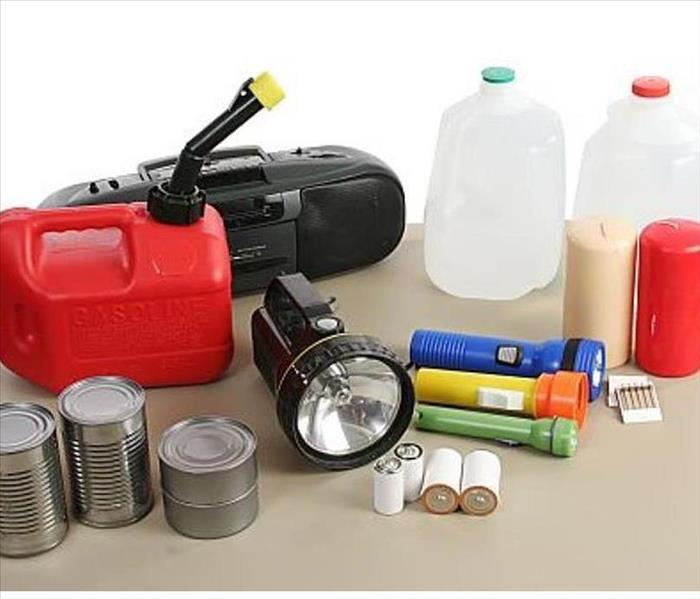
Flooding can happen fast in many environments. The American Red Cross recommends having the following list of items packed and ready to go in the event of an evacuation due to flooding.
- Water- 3+ day supply; one gallon per person
- Food- 3+ day supply of non-perishable, easy to prepare food.
- Flashlight
- Battery powered or hand crank radio
- Extra batteries
- First Aid Kit
- Medications- 7 day supply and medical items such as glasses, hearing aids, contact etc.
- Multi-purpose tool
- Sanitation and personal hygiene items
- Copies of personal documents such as medication list, ID, lease or deed etc.
- Cell phone with chargers
- Family and emergency contact information
- Extra Cash
- Emergency Blanket
- Maps of the area
- Baby supplies
- Pet supplies
- Tools/Supplies for securing your home
- Extra set of car keys and house keys
- Extra clothing, hat and sturdy shoes
- Rain gear
- Insect repellent
- Camera for photos of damage
2018 US Summer Forecast
6/14/2018 (Permalink)
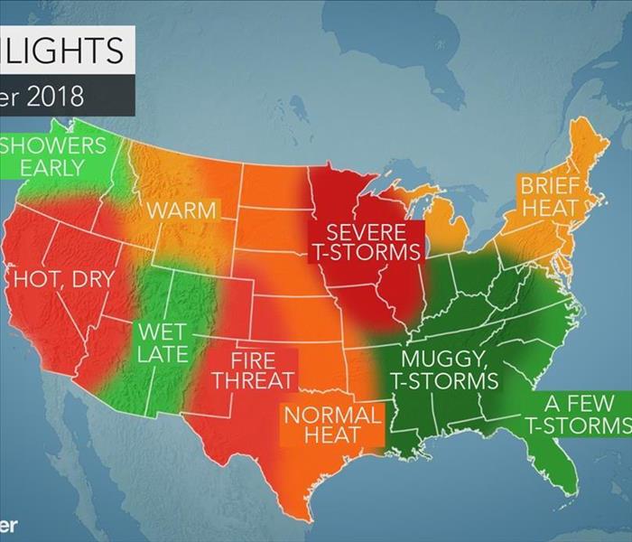
2018 US summer forecast: Early tropical threat may eye South; Severe heat, drought to bake southern Plains
By Jillian MacMath, AccuWeather staff writer
May 02, 2018, 8:01:15 AM EDT
Share this article:
The Northeast and mid-Atlantic are in for a bit of everything this summer as the weather transitions between hot, humid and stormy.
Meanwhile, the southern United States will endure persistent storms and the threat for an early tropical impact.
In the Southwest and California, building heat and dryness will pose a high risk for wildfires.
Summer to bring heat, humidity and severe weather to Northeast, mid-Atlantic
From heat to humidity and severe weather, the Northeast and mid-Atlantic are set to experience a bit of everything this summer.
A few hot periods will take hold throughout the summer, though it won’t be persistent.
“I think there’s going to be surge later in June when we really start to feel some heat here in the Northeast. But will it stick around the whole summer? I don’t think that’s going to happen,” AccuWeather Expert Long-Range Forecaster Paul Pastelok said.
I-95 cities, including New York City, Boston and Philadelphia, are predicted to average close to normal with respect to the number of 90-degree days.
“Humidity-wise they’ll have to watch out for August. That may be up a little bit,” he said.
Severe weather could strike the northern mid-Atlantic states and eastern Ohio in June.
In July, that risk will shift farther northward.
Showers and thunderstorms to target the Southeast, Tennessee Valley, Gulf Coast
A barrage of showers and thunderstorms will target the Southeast, with Florida set to bounce back from severe drought conditions.
“They’re going to see some more action across the peninsula throughout the summer, which is good for them. I don’t see any dry conditions developing like we saw a couple of years ago,” Pastelok said.
Heavier storms will pose a risk for flooding with the Tennessee Valley and central Gulf coast facing the greatest threat.
Meanwhile, the entire region will be at risk for an early tropical impact.
“The last several years we’ve seen early tropical hits. I don’t see anything against that this year. Whereabouts? That’s a tough call. Anywhere is possible along the Gulf coast this year,” Pastelok said.
If a tropical system does impact the region, it’s more likely to be a tropical storm which would pose a greater risk for flooding rainfall, he said.
Severe weather to threaten the western Ohio Valley, Midwest, central/northern Plains
Short-term periods of high heat will blast the region in June, though temperatures will bounce up and down throughout the summer.
Severe weather will also target the first month of the season.
“June, I think, will be the month for the severe weather in the northern Plains,” Pastelok said. “It could linger a bit into July, but it will take a break before coming back in August.”
Stifling heat, drought to grip the southern Plains
Severe drought is predicted to continue across the southwestern Plains as intense heat dominates the summer.
June could end up being one of the top-five hottest on record for the region.
“Places like Dallas, Amarillo, Oklahoma City, those places are going to record above-normal temperatures and below-normal precipitation this summer,” Pastelok said.
The forecast could spell bad news for cattle farmers and consumers alike.
“The Plains drought could have an effect on agriculture and grazing for cattle,” Pastelok said. “The grass is not going to grow as much, so farmers are going to end up spending more on feed.”
High fire threat for the Southwest, California as heat and dryness build
Heat and drought will also stretch into the Southwest and California.
The fire threat in both of places will arrive early then remain high for a good part of the summer before rainfall increases into July and August.
Flash flooding is possible as precipitation increases for the interior Southwest and the central Rockies around the midpoint or latter half of the season.
Typical summer to transpire in Northwest, Rockies
Following a typical pattern for the Northwest and Rockies, late spring and early summer will remain mostly wet and cool.
The transition to warmer and drier summer weather won’t arrive until later in the season.
As the warmth increases in mid-July and August, drought conditions may develop east of the Cascades.
This could result in the threat for fires from late summer and into the fall season.
Prepare for Spring Weather
4/13/2018 (Permalink)
 Spring Storms
Prepare for Spring Weather
Spring is the time of year when many things change—including the weather. Temperatures can swing back and forth between balmy and frigid. Sunny days may be followed by a week of stormy weather. Sometimes extreme weather changes can occur even within the same day. Mark Twain once said, “In the spring I have counted one hundred and thirty-six kinds of weather inside of four and twenty hours.”
Thunderstorms cause most of the severe spring weather. They can bring lightning, tornadoes, and flooding. Whenever warm, moist air collides with cool, dry air, thunderstorms can occur. For much of the world, this happens in spring and summer.
Because spring weather is so unpredictable, you may be unprepared when severe weather hits—particularly if you live in a region that does not often experience thunderstorms, tornadoes, or flooding. And when severe weather hits unexpectedly, the risk of injury and death increases. So planning ahead makes sense; prepare for storms, floods, and tornadoes as if you know in advance they are coming, because in the spring, they very likely will.
Advance planning for thunderstorms, lightning, tornadoes, and floods requires specific safety precautions. You can follow many of the same steps that you would for all extreme weather events. Keep an emergency kit on hand. Some items to include are:
- A battery-operated flashlight, a battery-operated NOAA Weather Radio, and extra batteries for both
- An emergency evacuation or shelter plan, including a map of your home and, for every type of severe weather emergency, routes to safety from each room
- A list of important personal information, including:
- telephone numbers of neighbors, family, and friends
- insurance and property information
- telephone numbers of utility companies
- medical information
- According to the American Red Cross a first aid kit may include:
- non-latex gloves
- assortment of adhesive bandages
- antibiotic ointment
- sterile gauze pads in assorted sizes
- absorbent compress dressings
- tweezers
- scissors
- adhesive cloth tape
- aspirin packets (81 mg each)
- first aid instruction booklet
(NOTE: Customize your first aid kit to meet your individual and family needs.)
- A 3–5 day supply of bottled water and nonperishable food
- Personal hygiene items
- Blankets or sleeping bags
- An emergency kitin your car
Prepare your family members for the possibility of severe weather. Tell them where to seek appropriate shelter as soon as they are aware of an approaching storm. Practice your emergency plan for every type of severe weather. Show family members where the emergency supplies are stored, and make sure they know how to turn off the water, gas, and electricity in your home.
Often by the time we are aware of an approaching storm, we have little if any time to prepare for it. But we do know that when spring arrives, thunderstorms, tornadoes, and floods are real possibilities. So why not take the surprise factor out of severe weather and prepare yourself, your family, and your home? If thunderstorms, tornadoes, and floods do occur, you’ll be ready for them.
Dangers of Winter Weather- Southern MD
11/29/2017 (Permalink)
 Winter Storm
There are a number of different ways that winter storms can impact a region and the people who live there. Winter storms are considered deceptive killers because most deaths are not directly related to the storm itself. People could get in an automobile accident on icy roads, have a heart attack while shoveling snow, or suffer frostbite or hypothermia from prolonged exposure to the cold.
Wind - Some winter storms have extremely strong winds that can create blizzard conditions with blinding, wind driven snow, drifting, and dangerous wind chills. These intense winds can bring down trees and poles, and can also cause damage to homes and other buildings.
Snow - Heavy snow accumulations can immobilize a region and paralyze a city, strand motorists, stop the flow of supplies, and disrupt emergency services. Buildings may collapse, and trees and power lines can be destroyed from heavy snow. In rural regions, homes and farms may be isolated for days, and livestock could be lost.
Ice - Heavy ice accumulations can bring down objects like trees, utility poles and lines, and communication towers. Power can be disrupted or lost for days while utility companies repair the damage. Even a small amount of ice can cause hazardous conditions for motorists and pedestrians.
Cold - Extremely cold temperatures can accompany winter storms and be left in their wake. Infants and the elderly are most susceptible to prolonged exposure to the cold, which can cause potentially life-threatening conditions such as hypothermia and frostbite. Below freezing temperatures can damage vegetation and cause pipes to freeze and burst inside homes. Exposure to cold can cause frostbite or hypothermia and become life-threatening.
What constitutes extreme cold varies in different parts of the country. In the South, near freezing temperatures are considered extreme cold. In the North, extreme cold means temperatures well below zero. Freezing temperatures can cause severe damage to citrus fruit crops and other vegetation. Pipes may freeze and burst in homes that are poorly insulated or without heat.
Wind Chill is not the actual temperature, but rather how wind and cold actually feel on exposed skin. As the wind increases, heat is carried away from the body at an accelerated rate, driving down the body temperature. Animals are also affected by wind chill; however, cars, plants and other objects are not.
Frostbite is damage to body tissue caused by extreme cold. A wind chill of -20° Fahrenheit (F) with light winds will cause frostbite in just 30 minutes. Frostbite causes a loss of feeling and a white or pale appearance in extremities, such as fingers, toes, ear lobes or the tip of the nose. If symptoms are detected, get medical help immediately! If you must wait for help, slowly re-warm affected areas.
However, if the person is also showing signs of hypothermia, warm the body core before the extremities. Hypothermia is a condition brought on when the body temperature drops to less than 95°F, and it can kill. For those who survive, there is likely to be lasting damage to the kidneys, liver and pancreas. Warning signs include uncontrollable shivering, memory loss, disorientation, incoherence, slurred speech, drowsiness and apparent exhaustion. Take the person’s temperature. If below 95°F, seek medical care immediately!
If Medical Care is Not Available, warm the person slowly, starting with the body core. Warming the arms and legs first drives cold blood toward the heart and can lead to heart failure. If necessary, use your body heat to help. Get the person into dry clothing and wrap them in a warm blanket, covering the head and neck. Do not give the person alcohol, drugs, coffee, or any hot beverage or food. Warm broth is an excellent choice.
Dangers of Winter Weather
11/6/2017 (Permalink)
 Winter Storm
There are a number of different ways that winter storms can impact a region and the people who live there. Winter storms are considered deceptive killers because most deaths are not directly related to the storm itself. People could get in an automobile accident on icy roads, have a heart attack while shoveling snow, or suffer frostbite or hypothermia from prolonged exposure to the cold.
Wind - Some winter storms have extremely strong winds that can create blizzard conditions with blinding, wind driven snow, drifting, and dangerous wind chills. These intense winds can bring down trees and poles, and can also cause damage to homes and other buildings.
Snow - Heavy snow accumulations can immobilize a region and paralyze a city, strand motorists, stop the flow of supplies, and disrupt emergency services. Buildings may collapse, and trees and power lines can be destroyed from heavy snow. In rural regions, homes and farms may be isolated for days, and livestock could be lost.
Ice - Heavy ice accumulations can bring down objects like trees, utility poles and lines, and communication towers. Power can be disrupted or lost for days while utility companies repair the damage. Even a small amount of ice can cause hazardous conditions for motorists and pedestrians.
Cold - Extremely cold temperatures can accompany winter storms and be left in their wake. Infants and the elderly are most susceptible to prolonged exposure to the cold, which can cause potentially life-threatening conditions such as hypothermia and frostbite. Below freezing temperatures can damage vegetation and cause pipes to freeze and burst inside homes. Exposure to cold can cause frostbite or hypothermia and become life-threatening.
What constitutes extreme cold varies in different parts of the country. In the South, near freezing temperatures are considered extreme cold. In the North, extreme cold means temperatures well below zero. Freezing temperatures can cause severe damage to citrus fruit crops and other vegetation. Pipes may freeze and burst in homes that are poorly insulated or without heat.
Wind Chill is not the actual temperature, but rather how wind and cold actually feel on exposed skin. As the wind increases, heat is carried away from the body at an accelerated rate, driving down the body temperature. Animals are also affected by wind chill; however, cars, plants and other objects are not.
Frostbite is damage to body tissue caused by extreme cold. A wind chill of -20° Fahrenheit (F) with light winds will cause frostbite in just 30 minutes. Frostbite causes a loss of feeling and a white or pale appearance in extremities, such as fingers, toes, ear lobes or the tip of the nose. If symptoms are detected, get medical help immediately! If you must wait for help, slowly re-warm affected areas.
However, if the person is also showing signs of hypothermia, warm the body core before the extremities. Hypothermia is a condition brought on when the body temperature drops to less than 95°F, and it can kill. For those who survive, there is likely to be lasting damage to the kidneys, liver and pancreas. Warning signs include uncontrollable shivering, memory loss, disorientation, incoherence, slurred speech, drowsiness and apparent exhaustion. Take the person’s temperature. If below 95°F, seek medical care immediately!
If Medical Care is Not Available, warm the person slowly, starting with the body core. Warming the arms and legs first drives cold blood toward the heart and can lead to heart failure. If necessary, use your body heat to help. Get the person into dry clothing and wrap them in a warm blanket, covering the head and neck. Do not give the person alcohol, drugs, coffee, or any hot beverage or food. Warm broth is an excellent choice.
Get a Head Start in Advance of Specific Severe Weather Threats
10/19/2017 (Permalink)
 RISK
RISK
Get a Head Start in Advance of Specific Severe Weather Threats
While emergency planning ideally is a twelve-month priority, the start of the severe weather season in your area is a good time to refocus your efforts. This is the time to:
- Designate an employee to monitor weather reports and alert your team to the potential of severe weather.
- Review your business continuity plan and update as needed, including employee contact information.
- Remind employees of key elements of the plan, including post-event communications procedures and work/payroll procedures. Make sure all employees have a paper copy of the plan. Review emergency shutdown and start-up procedures, such as electrical systems, with appropriate personnel, including alternates.
- If back-up power such as a diesel generator is to be used, test your system and establish proper contracts with fuel suppliers for emergency fuel deliveries.
- Re-inspect and replenish emergency supplies inventory, since emergency supplies are often used during the offseason for non-emergency situations.
- Test all life safety equipment.
- Conduct training/simulation exercises for both your business continuity and emergency preparedness/response plans.
5 Days Before Storm Conditions – Start to Focus on What Needs to Get Done
- Notify employees of the potential for severe weather and to be prepared for the emergency plan possibly to be implemented.
- Inspect the roof and grounds for loose debris, which may become a hazard in high winds. If staff or temporary help is available, begin removal of the debris, otherwise the removal may be done at the 72-hour interval.
- Provide a list of storm tips and needed supplies to help your employees prepare their homes and families. The Insurance Information Institute (III) has developed a free “Know Your Plan” app to help families make their own emergency plan; it also features property protection guidance from IBHS. The app is available in iTunes, or by searching “Insurance Information Institute” in the App store from any Apple device.
- Ensure all employees have your business’ designated emergency telephone numbers and key contact other information (i.e., employee emergency wallet card).
72 Hours before Storm Conditions—Time to Activate the Plan
- If not completed already, remove or secure all loose roof and ground items, including landscaping that may become wind-borne debris.
- Clear roof drains, gutters and downspouts of debris, to prevent water back-up
- Clean out all debris from outdoor perimeter drains, especially in areas where water may collect such as shipping and receiving areas where the ground slopes towards the building.
- Fill emergency generators with fuel and contact fuel suppliers with anticipated needs for post-storm deliveries.
- Ensure fire protection systems are in proper working order.
- Notify key customers, suppliers, and partners of office/facility closing and contingency plans (post office, Fed Ex, UPS, cleaning service, building management, vendors, etc.).
- Make decisions on when to excuse employees so that they have sufficient time to prepare their homes and families, and notify employees of office closure details.
- Make any necessary alternative travel arrangements for employees away on business.
- Customize messages for business’ website, telephone recording, employee intranet, etc.
- Decide which outstanding invoices, bills, expense reports, etc. should be paid by your accounts payable department, before a possible closure
- Instruct employees with laptops to take them home at the end of each day and confirm that they can connect to your business’ server from home.
- Remind employees to make sure their cell phones are fully charged and that they have a power cord and car charger.
- Advise employees to begin checking your employee emergency hotline and/or company intranet/website for updates on the status of your office/facility.
48 – 24 Hours before Storm Conditions – Finalize Preparations and Make Sure Employees are Safe
- Process accounts payable and payroll. Protect or relocate vital records.
- Make sure all employees with calling responsibilities have the most updated version of the company telephone call list and have it in multiple formats (hard copy, electronically, etc.).
- For hurricanes and other high wind events, install window protection; if window protection is unavailable, close all window blinds, and cover office equipment with plastic sheets or tarps.
- Close and lock all office doors, especially perimeter offices.
- If you expect your building to be exposed to flooding or storm surge, seal all water entry points such as utility penetrations into the building and install flood protection including first-floor drain plugs.
- Conduct full/partial shutdown procedures. If volunteers are to remain onsite during the storm, make sure they can remain in a safe and secure area. If conditions permit, instruct them on how to monitor, document, and mitigate against leaks and water infiltration in critical areas with vital equipment.
- Advise employees to check the status of your office/facility at least twice per day.
- Disconnect all electrical equipment and unplug from power source.
- Place a “Closed” notice on office/facility main entrance.
During and Immediately After the Storm
- Update employee emergency hotline and/or company intranet and company website with postings on the status of your operations.
- Activate the company telephone call list process, in order to contact all employees regarding the status of your office/facility.
- Designate times for key staff members to call into conference calls for situation overviews.
Recovery: After the Storm
- Designated personnel should return to the facility, assess conditions, document damages, and notify the emergency operations teams of their findings.
- When it is deemed safe, designated personnel should begin start-up procedures.
- When all safety and operational concerns are addressed and an “All Clear” is provided, employees can return to work.
- Activate employee communications tools and local media contacts to give notice of re-opening.
- Take an overall inventory, including photos of all damaged property, and report damage and related expenses to your insurance company.
- Employees returning to the building should be instructed to examine their work area, test all office equipment and report findings back to the designated staff contact.
- Notify key customers, suppliers, and partners of office/facility re-opening and any necessary property or operational changes resulting from storm damage.
A Hurricane Preparedness List
9/18/2017 (Permalink)
 A Hurricane Preparedness List
A hurricane preparedness checklist will provide reassurance that you will have thought of all the essentials (provided that they are on the list) and will greatly reduce the likelihood that you will forget something during the stressful time immediately before a potential hurricane disaster.
Note: No list is a perfect or complete list because we all have our own unique circumstances, concerns, and existing resources. Besides, it would take a book to complete one… That said perhaps this list will help get you going in the right direction. It is intended to provoke thought, prepping & preparedness for a hurricane.
HURRICANE PREPAREDNESS: GENERAL SUPPLIES
- Pack a “Bug Out Bag” and/or “72 hour kit”: This bag of contents should be packed with essential supplies, food & water, clothing, and whatever you feel is important to have during an evacuation. There are lots of articles on our site with more specifics…
- Cash: ATMs and credit card machines may not work for a while after the storm.
- Battery-operated radio: Make sure you have extra batteries too, so that you can keep up with news reports and alerts. Hand-crank radios work well, too.
- Secure a two-week supply of prescription medicine: Anyone on prescription medications, should pack a two-week supply of their meds in a sealable plastic bag, clearly labeled.
- Flashlight and lanterns: Make sure you have a couple of flashlights, candles, matches, lanterns and other alternate sources of light.
- Personal hygiene items: It might be hard to get to the store to buy toilet paper, tissues, soap and other sanitary items after the storm.
- Extra keys: Having an extra set of keys in your kit is a good idea in case people get separated or if they’re lost in a flood or the confusion.
- Pet items: Remember food, medicine and water for your pet, too.
- Disinfectant: You never know what mess you’ll have after a storm.
- Checklist: Customize your own hurricane preparedness checklist and print it out for your reference.
- Extra batteries: You’ll need extra batteries for your radio, flashlights, and other items. Get these early before they all sell out.
- Prepare early: Emergency items sell out quickly at the stores, so stock up your kit before hurricane season even starts.
C. Crane Company Emergency Radio
Emergency Solar Charger for Phones and USB devices
Related articles on MSB:
Bug out
72 hour kits
HURRICANE PREPAREDNESS: FIRST AID
- Basic First Aid Kit: Keep this on hand for general purpose.
- Antiseptic solution: Keep this on hand to keep infections at bay.
- Allergy medicine: Storms can blow in all kinds of stuff that drive your allergies wild.
- First aid instructions: Know some basic First Aid skills such as how to stop bleeding, the Heimlich, CPR, and other basic aid in case you need it in an emergency.
- Mosquito repellent: If it floods — or even rains a lot — your area could have a serious and potentially dangerous mosquito problem.
- Prescription glasses: If you run out of contact solution or all the nastiness in the air after a storm irritates you, you’ll have back-up glasses.
- Adhesive tape: You can use this to fasten bandages, hold large lacerations together and even splint broken bones.
- Gauze, bandages and band-aids: Even little cuts and scrapes need to be dressed, so have a range of bandages on hand.
- Hand sanitizer: Nothing compares to soap and water, but in a fix, hand sanitizer with at least 60% alcohol will help.
Related article:
Best First Aid Kit 2017
First Aid Skills
HURRICANE PREPAREDNESS: REPAIR AND MAINTENANCE
- Plywood: Nailing plywood over windows is still the best option for protecting the inside of your house.
- Sand bags: If you live in a low area, especially, use sand bags to dispel water.
- Bring outside furniture indoors: Move patio furniture and pool toys into the garage.
- Turn off utilities if you leave: Before evacuating, shut off power, propane gas and water, but leave on natural gas unless told to do so by authorities. A licensed professional is the only one who can turn it back on.
- Anchor mobile homes: Pre-1994 construction mobile homes probably aren’t anchored well enough to stand even Category 1 hurricanes.
- Buy impact resistant glass: Well before you hear about any storms, replace older windows with higher resistance ones.
- Lock windows and doors: Lock up your windows and doors for personal safety and to keep the wind from blowing them open.
- Prune trees and shrubs: Loose limbs and plants will fly around easily when the winds pick up.
- Get storm shutters: Place these over glass doors, windows and skylights.
- Check smoke and carbon monoxide detectors: Make sure these will work even if the power is out.
- Buy tarps and rope: Already have these items on hand so that you can start repairs as quickly as possible to prevent more damage.
- Fill bathtub with water: If you’re going to get hit pretty badly, give your family an extra supply of water by filling a sanitized bathtub.
WaterBOB Emergency Drinking Water Storage
Emergency Gas & Water Shutoff Tool
HURRICANE PREPAREDNESS: FOOD AND WATER
- Food and water should last for 72 hours: Make sure you have enough supplies to last everyone in the house for at least 72 hours. More is better!
- Quality Water Filter: Clean drinking water is a top priority. Get a quality water filter!
- Use good food rotation practices: If you’re keeping an emergency kit stocked with some food supplies, replace food items every six months to ensure freshness and safety.
- Be aware of “boil water” alerts: After a storm, you may have to boil water for a few days due to flooded wells, spilled sewage and other contamination.
- Get out your ice chest: Fill an ice chest with ice or dry ice before and after the storm to keep food cold.
- Canned foods: Canned meat, fish, fruits, soups, milk and vegetables are all smart, easy-to-prepare options.
- Stock up on non-perishable foods: The power will probably go out, so acquire foods that don’t require refrigeration.
- Cooking without electricity: Fill your BBQ grill tank. Do you have a camp stove?
- Use camping gear: If you have basic camping gear like a small grill, you can make simple meals while the power’s out.
- Baby formula, diapers: Don’t forget to store enough baby formula, baby food, diapers, if this applies to your situation.
Big Berkey Countertop Water Filter
Without Electricity: Level-1 Prepping & Preparedness
HURRICANE PREPAREDNESS: POWER OUTAGES
- Consider a generator: A generator will make your life much easier during and after a storm if the power goes out — but run it outside!
- Keep phone numbers of energy companies handy: Write down or store in your phone the numbers of energy providers so that you can notify them of an outage.
- Use grills and gas cook stoves outside: Gas grills and generators carry a carbon monoxide risk.
- Stay away from downed power lines: Let trained workers clean up the damage.
- Have a realistic understanding of restoration times: It may take longer than you think. Having MORE food and water than 72 hours is a very good idea.
- Drink lots of water: When it’s hot and you don’t have A/C, drink water to stay cool and hydrated.
- Know how to connect a generator: Be sure that you or someone understands how to do this, and the dangers and precautions that must be met if connecting to the homes electrical system.
HURRICANE PREPAREDNESS: ENTERTAINMENT
- Board games or cards: Get out board games or play cards to keep you distracted during the storm and to play if the power goes out.
- Read: Read a book! If the power is out, today’s modern electronic entertainment will be too…
- Play with your pets: Give your pets extra attention, especially if they seem stressed or scared.
- Play charades: Games like charades or hide and go seek don’t require any power and are fun with the kids.
- Tell stories: Kids love to hear stories.
- Get to know your family better: A perfect time to ‘talk’ together instead of everyone’s head stuck in an electronic device.
Kids and Pets: Level-1 Prepping and Preparedness
HURRICANE PREPAREDNESS: SPECIAL NEEDS AND CHILDREN
- Minimize stress: Help children cope better by minimizing stressful situations and discussions.
- Limit TV time: Don’t let your kids watch scary footage of the storm on TV.
- Maintain normal routines: Keeping up with a somewhat normal routine helps soothe everyone from babies to adults, provided that you are already prepared.
- Contact home health care service: If you use a home health care service, call them and ask for advice regarding the impending storm.
- Answer children’s questions: Welcome questions from children about what to do, what a hurricane is, and how to prepare for it.
- Get older kids to help: School-aged children will feel more prepared and maybe even excited if they’re allowed to help gather supplies, find the flashlights & batteries, etc..
- Bunk with the neighbors: If you’re elderly, ask to spend the night at the neighbors’ house, or work out some kind of signal for help should you need it and if the phones go out.
- Stay hydrated: People who are sick and the elderly are especially at risk for dehydration.
- Know the risks: Disabled individuals will find it harder to evacuate, so know all the obstacles and risks involved in transporting them or keeping them safe in your home.
HURRICANE PREPAREDNESS: EVACUATING
- Find a place for pets ahead of time: If you’re unable to take your pets with you, make arrangements ahead of time, and never leave your pet chained up / alone on your property. It’s cruel.
- Get a real map: You may not be able to rely on your GPS, especially if roads are blocked or flooded. Get a real map to help you find your way out.
- Let someone know where you’re going: Contact family or friends before you evacuate and let them know your planned destination. If you lose contact, this will help alleviate questions and concerns.
- Sleeping bag: Get a sleeping bag, blankets and pillows ready if you have to evacuate.
- Keep your gas tank full: Fill it up all the way. Even when you’re on the road try not to let your tank get below half full.
- Familiarize yourself with evacuation routes: There should be standard routes, but listen to the news to learn about any new or updated routes. They will get clogged. Leave early! Consider back roads.
- Plan to stay with friends: Hotels will book up quickly, so plan to stay with friends or family who live inland at least for the first couple of nights.
- Leave early if forecasts look bad for your area: Avoid the worst traffic and road closures. Don’t wait if it looks like your area will be in the hurricane.
- Carefully inspect your home upon return: Before letting children back, watch for danger, hanging electrical wires, loose debris, broken glass, etc..
Road Atlas Map For Each State
HURRICANE PREPAREDNESS: PAPERWORK
- Emergency contact information: Hard copy of all important phone numbers and other emergency contact information in your preparedness kit. Don’t rely on having a charged cell phone and it’s contact list.
- Prioritize what’s important: You can’t take everything with you, but consider important documents such as deeds, wills, birth certificates, passports, important financial statements, etc..
- Use a USB thumb drive: Download important data onto a flash drive and put it in a waterproof, sealable bag or container.
- Check home insurance: Do this before hurricane season starts, otherwise updated coverage may not take effect until the following year. Also look into flood insurance.
- Write down serial numbers: In case important belongings are stolen or lost in the storm, you might need serial numbers as proof for insurance.
- Video your belongings: Walk through the house and video everything you own. Great proof for insurance claims.
- Proof of residence: A driver’s license or mail should suffice.
- Use a fireproof / waterproof safe: A fireproof safe will keep your belongings protected.
HURRICANE PREPAREDNESS: STAYING INFORMED
- Know the terminology: Know the difference between tropical depressions, tropical storms and hurricanes so that you can follow the reports better.
- Listen for warnings: Heed the advice especially if ‘they’ are advising to evacuate. Listen for what the weather forecasters and/or emergency management people are saying.
- Stay up to date with a weather radio: Best Weather Radio
HURRICANE PREPAREDNESS: SAFETY
- Head to a windowless room: Even if your windows are boarded up, stay in a windowless room while the winds are blowing.
- Stay downwind: This area is the opposite side of the house that the wind is hitting.
- Stay inside: Stay indoors for the entire duration of the storm, and do not go outside during the calm of the storm, when the eye passes over.
- Be careful with candles: Only light them if you have to, and set a reminder to blow them out before leaving the room or going to bed.
- Personal Security: Unfortunately the reality is that the bad element takes advantage during disasters. Do what you need to do regarding your own personal security.
How to Prepare for a Power Outage
9/18/2017 (Permalink)
 How to Prepare for a Power Outage
How to Prepare for a Power Outage
Posted on 2017-03-10 12:52:43 by Jennifer
Weather can be unpredictable, and we need to keep ourselves and loved ones safe during a bad storm. Here are some basic things you can do to prepare your home for loss of power any time of year:
Things to do before a power outage
- Be prepared for injuries. You should have an emergency kit at your home that's fully stocked with bandages in various sizes, sterile dressings and gloves, hand sanitizer and antibiotic towelettes, a thermometer, pain medicines, tweezers, and scissors. Make sure you purchase or build your own first aid kit that is large enough for your family.
- Make sure your generator is up and running. Review generator safety tips before using your generator for the first time each year.
- Stock up on bottled water. Water purification systems may not work when the power goes out.
- Purchase a battery operated or hand cranked radio to stay tuned into news and emergency information when power is out.
- Fill up all your vehicles’ tanks in case gas stations lose their power as well. Remember, if you're using a generator they require roughly 12-20 gallons of gas per day. Store all fuel away from the house.
- Have car chargers for cell phones and keep a corded phone as well. Cordless phones require AC power. Keep in mind cell phones may be more reliable than landline phones when local service is disrupted.
- Be prepared for special needs. Tell your utility and local fire department before a storm if someone in your home uses an oxygen concentrator, ventilator, or medical bed, as power may be restored to you sooner. Always keep a one month supply of medication on hand.
Don’t get caught in the dark
- Keep a few emergency automatic power failure night lights plugged in. Place them in dark hallways, bedrooms, common areas, basements, and garages. Emergency lights can last from 6-20 hours depending on the model. These can come in handy the first couple of hours during a power outage, especially when you're trying to make your way around a dark home.
- Have candles and plenty of matches available. Make sure you keep your candles away from anything flammable, such as drapes.
Food Safety: What to do when power remains out for over 4 hours
- Invest in a cooler and ice packs. Keep the cooler in a convenient location inside your home and ice packs in the freezer. When the power goes out, don't open your refrigerator if you don't have to, unless the power outage lasts longer than 4 hours. After 4 hours, get your cooler and ice packs and pack items from your refrigerator into your cooler. Throw away any food that has a temperature of more than 40 degrees Fahrenheit.
- If your freezer is half full, it will hold safely for up to 24 hours. A full freezer will hold safely for 48 hours – don't open the freezer if you can avoid it.
- Get the right food before you lose power. Keep at least a 3-day supply of nonperishable foods such as crackers, whole-grain cereals, and canned goods. Don’t forget a manual can opener!
It's important to plan ahead and be prepared, as you never know when a bad storm or power surge will hit. Sudden power outages can be frustrating and troublesome, but being prepared can eliminate some of that stress. For prolonged power outages, it may be wiser to seek shelter with friends, family, or at a hotel. Stay safe!
What You Can do Before Severe Weather Strikes
8/31/2017 (Permalink)
What You Can do Before Severe Weather Strikes
Fact: Hundreds of people die each year in the United States due to heat waves, hurricanes, lightning, flash floods, powerful thunderstorm winds, and winter storms or winter cold. Additionally, thousands of people are injured by these weather events each year. Will it happen to you?
Fact: If you are aware of what weather event is about to impact your area, you are more likely to survive such an event. To stay on top of the weather, utilize NOAA Weather Radio All Hazards receiver units that can be purchased at most electronic stores. Make sure the model you purchase has a battery-backup. The programmable types allow you to selectively screen out those county warnings you are not interested in. Most homes have a smoke detector; shouldn’t your home also have a weather radio?
What You Can do Before Severe Weather Strikes
- Develop a disaster plan for you and your family at home, work, school, and when outdoors. The American Red Cross offers planning tips and information on a putting together a disaster supplies kit at: http://www.redcross.org
- Identify a safe place to take shelter. Information on how to build a Safe Room in your home or school is available from the Federal Emergency Management Agency at: http://www.fema.gov/hazard/tornado/to_saferoom.shtm
- Know the county/parish in which you live or visit – and in what part of that county you are located. The National Weather Service issues severe weather warnings on a county/parish basis, or for a portion of a county/parish.
- Keep a highway map nearby to follow storm movement from weather bulletins.
- Have a NOAA Weather Radio All Hazards receiver unit with a warning alarm tone and battery back-up to receive warning bulletins.
- National Weather Service (NWS) watches and warnings are also available on the Internet. Select your local NWS office at: http://www.weather.gov/organization.php …or go to the to the NWS Home Page at http://www.nws.noaa.gov
- Listen to commercial radio or television/cable TV for weather information.
- Check the weather forecast before leaving for extended periods outdoors. Watch for signs of approaching storms.
Tornado Safety Tips:
8/31/2017 (Permalink)
Tornado Safety Tips:
- Seek shelter in a sturdy building, or a pre-designated shelter. Go to the lowest level of the building, preferably in a basement, and get under a heavy desk or workbench or sit next to the wall and cover your head with your arms/hands. Best bet – have a safe room in the basement.
- If an underground shelter is not available, move to an interior room/hallway – put as many wall between you and the outside of the building, and stay away from windows. Other possibilities: get into a bathtub or under a bed or sofa.
- Get out of vehicles – they can easily be tossed around – do not try to outrun a tornado.
- If caught outside – lie flat on the ground and cover your head with your hands. Remember, in tornado situations debris likes to settle in roadside ditches or other low spots. If heavy rains are falling in the area, ditches and low spots may quickly flood. Therefore, laying down in a ditch may not be your best choice.
- Be aware of flying debris – most deaths and injuries are caused by flying debris.
- Manufactured homes (mobile trailers) offer little protection, even if tied down. Leave these for a sturdy shelter before the storm approaches.
- Do not seek shelter under a highway overpass. Wind blow stronger under the overpass due to the wind-tunnel effect. Additionally, flying debris (glass, wood, metal) can pummel you, and the tornado winds may suck you out from under the overpass anyway.
- Don’t waste time opening windows and doors to equalize air pressure differences – this is a waste of time and buildings have enough air leakage to equalize air pressure differences anyway. Buildings are more likely to explode after the wind gets inside.
- The southwest side of the basement isn’t necessarily the safest place to be – vehicles can be pushed into basements – you can still be crushed no matter where you are in the basement. Even the bricks/stones of a fireplace can crash into the basement and crush you!
- Remember – the tornado can occur before there is a visible funnel cloud. A tornado is nothing more than a violently rotating column of air extending from the ground to the cloud base. You may not be able to see the tornado (can’t see the rotating air) until enough debris and dirt get swept into the vortex, and/or the visible funnel cloud develops all the way to the ground.
- No place is totally safe from tornadoes (except for a safe room) – if weather conditions come together properly, the tornado will go over or through mountains, lakes, rivers, swamps, marshes, bogs, and through downtown areas that have 1000 foot skyscrapers!
STORM SAFETY TIPS:
8/31/2017 (Permalink)
STORM SAFETY TIPS:
Lightning Safety Tips:
- Postpone outdoor activities if thunderstorms are imminent. Lightning can travel 5-10 miles away from the thunderstorm and strike the ground with blue sky overhead. The storm doesn’t have to be overhead in order for you to be struck.
- Move to a sturdy shelter or vehicle. Do not take shelter in a small shed, under isolated trees, or in a convertible-top vehicle. Stay away from tall objects such as trees or towers or poles.
- If in your vehicle when lightning strikes – don’t touch a metal surface. You are safer in a vehicle than being outdoors.
- Remember that utility lines or pipes can carry the electrical current underground or through a building. Avoid electrical appliances, and use telephones or computers only in an emergency.
- If you feel your hair standing on end – get down into a baseball catcher’s position and plug your ears with your finger tips so if lightning does hit it will not blow your ear drums out. Do not lie flat!
- 30/30 rule – if the time between lighting and thunder is 30 seconds or less, go to a safe shelter. Stay there until 30 minutes after the last rumble of thunder.
Flash Flood/Flood Safety Tips:
- Nearly half of all fatalities in a flash flood involve a person driving a vehicle. Do not drive into a flooded area – Turn Around Don’t Drown! It takes only 2 feet of water to float away most cars. It’s amazing how powerful we feel when we get behind the wheel – don’t do it!
- It takes only 6 inches of fast-moving water to sweep a person off their feet – don’t walk through a flooded area!
- If you are camping in a river valley, move to higher ground if thunderstorms with heavy rains are in the area. Do not attempt to drive away.
- Don’t operate electrical tools in flooded areas.
- Most flash flood deaths occur in the middle of the night when it is more difficult to see rising water levels judge the depth of water covering road surfaces.
Severe Thunderstorm Straight-line Winds:
- Don’t underestimate the power of strong thunderstorm winds known as straight-line winds – they can reach speeds of 100 to 150 mph. Hurricane-force winds start at 74 mph. Wisconsin does experience these kinds of winds!
- If a severe thunderstorm warning contains hurricane-force wind speeds seek shelter immediately (as you would for a tornado situation).
- Stay away from windows and go to the basement or interior room/hallway. Do not use electrical appliances.
- Be aware that tall trees near a building can be uprooted by straight-line winds – that tree can come crashing through the roof of a home and crush a person to death.
- Powerful straight-line winds can overturn a vehicle or even make a person air-borne when they get up over 100 mph!
- One type of a straight-line wind event is a downburst, which is a small area of rapidly descending rain-cooled air and rain beneath a thunderstorm. A downburst can cause damage equivalent to a strong tornado!
Large Hail:
- Although it is rare, people have been killed by large hail stones after sustaining head injuries. Additionally, several people are injured by large hail stones each year in the U.S.
- Some thunderstorms can produce large hail stones that can reach the size of baseballs, softballs, or even as big as computer compact discs (CD) or DVDs! These large hail stones can fall at speeds over 100 mph! – that’s why they are dangerous! The largest hail stone in Wisconsin was over 7 inches in diameter!
- If a severe storm is producing large hail stones, seek a sturdy shelter and stay away from windows that can easily be smashed.
- If you are in your vehicle before the hail storm starts, get out of it and go to a sturdy shelter. Glass windows in vehicles can easily be smashed by the hail stones. If you can’t get out of your vehicle, then come to a stop and cover your head with your arms and hands.
When Storms or Floods hit Charles County SERVPRO is ready!
7/24/2017 (Permalink)
 Our highly trained crews are ready to respond 24/7 to storm or flood damage in Charles County.
SERVPRO ofCharles County specializes in storm and flood damage restoration. Our crews are highly trained and we use specialized equipment to restore your property to its pre-storm condition.
Faster Response
Since we are locally owned and operated, we are able to respond quicker with the right resources, which is extremely important. A fast response lessens the damage, limits further damage, and reduces the restoration cost.
Resources to Handle Floods and Storms
When storms hit Charles County we can scale our resources to handle a large storm or flooding disaster. We can access equipment and personnel from a network of 1,650 Franchises across the country and elite Disaster Recovery Teams that are strategically located throughout the United States.
Have Storm or Flood Damage? Call Us Today 301.753.8313
 Submersible pumps expedite SERVPRO's team to remove floodwaters in Waldorf properties prior to drying and disinfecting. Here to Help®


 24/7 Emergency Service